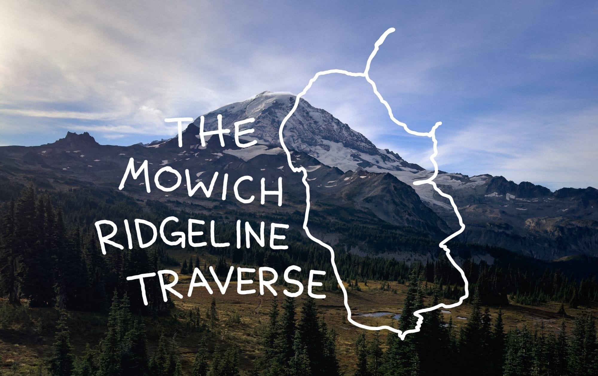
The Mowich Ridgeline Traverse
A 9 mile loop mountain-running around the north side of Mt. Rainier
I've been on a bit of a journey this year.
After falling head over heels for ski touring in the winter, I found myself with more endurance than ever before and an aching desire to leave trails behind and head into the backcountry. This hasn't been my summer M.O., I've been a steward of the popular hike and well known multi-pitch or crag, now neither seemed to hold the same appeal to me anymore once the snow began to melt out in June. So, I hung up my trad-rack and started exploring as best I could.
Over the summer, I joined a friend in an attempt to summit Mt. Index via the Persis traverse, I spent the better part of a week section hiking the PCT through the cascades, and I ran the Enchantments traverse with my wife and a friend. They were all great days in the mountains, but none of them gave me the specific rush I was looking for. I felt stuck. Stuck on well traveled routes and straddled down by my inability to find my own way. So, in August I began something new. I wanted to start finding my way off-trail (responsibly), I wanted to learn how to properly read a map and discern if I could venture there, I wanted to find the thing my heart had been looking for. I started spending hours scanning through the cascades in my free time. I was looking on every map I could find for more remote trails. Trails that intersected others to create loops or lollipops, trails that lead me further away than I had been before. I read trip report after trip report on random trail runs and mountain climbs. I was looking for the spaces between trails that were possible to traverse and create something new.
The first route I made on my own was an optimistic loop connecting a few peaks out by Keechelus Lake (Tinkham, Abiel, and Silver) via the PCT and a few smaller climbers trails. The feeling of crossing over Tinkham's multiple peaklets and continuing on was a bit intoxicating and gave me the inkling I was onto something. The rest of the peaks on the "loop" ended up requiring some out-and-back work to connect, which I found less ideal, but the experience opened my eyes to the thing I had really been looking for. I returned to my map scouring and put together a loop connecting a handful of peaks lining Kent ridge on the I-90 corridor (Dutchess of Kent, Duke of Kent, and Mt. Kent). This one went horribly, my optimism had exceeded my abilities and I ended up with no peaks, no loop, and torn up legs and arms from bushwhacking in shorts through maws of Devil's Club (perhaps the nastiest plant to grace the Cascadian slopes). I wasn't deterred though, perhaps even finding myself more stubbornly resolute, I kept on looking for more.
Through all of my research I had seen multiple reports for trail runs in an area around Mt. Rainier that I hadn't been to before, the Carbon Glacier/Mowich side. The reports showed stunning views and big aesthetic loops, mostly circumnavigating the mother group. I took a look for myself on the map and after putting together a half dozen possible routes I packed up the car and drove the long unpaved forest road out to Mowich Lake to see if one of them would go.
The Loop Begins
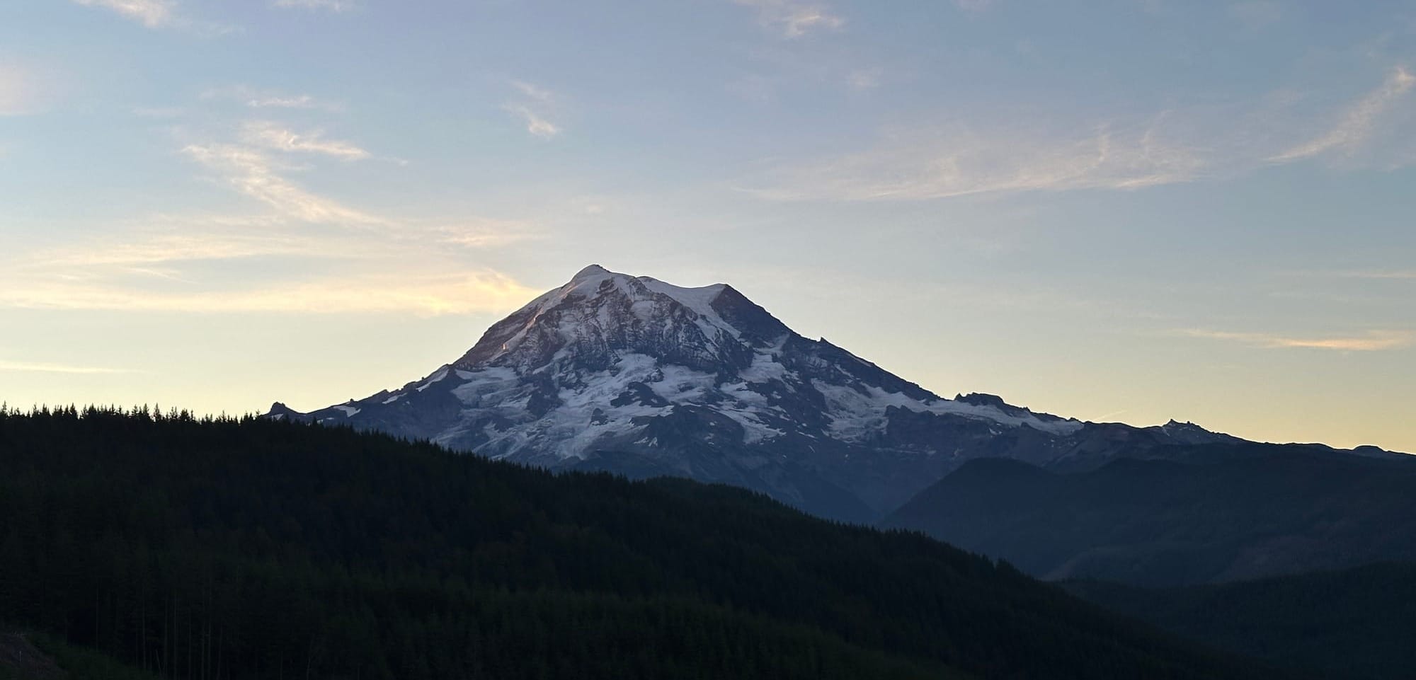
I arrived at the Spray Park trailhead early, trying to beat the crowds of people who would show up in the late morning to make their way up to the Tolmie fire lookout (by far the most popular reason for heading to this side of Rainier). I wasn't alone though, the parking lot was already full of backpackers and hikers buzzing about in the cold morning air. Some of them starting out on the Wonderland trail, others strapped with crampons and ice axes headed for the Carbon glacier. I was surprisingly the only light pack among them all, feeling underdressed in my shorts and run vest, but that was the way I preferred it as the chances of me spending my day in solitude continued to rise.
I ran the first two miles on the Spray Park trail before the terrain steepened and I slowed to a steady hike. I was heading out on my imagined loop counter-clockwise towards Mt. Pleasant where I was hoping I would be able to access the ridgeline heading towards Fay Peak and onwards. Once I finished the switchbacks above Spray Falls, I was pushed out into the Grant Creek Meadow where the trees fell away and Mt. Rainier opened up in front of me.
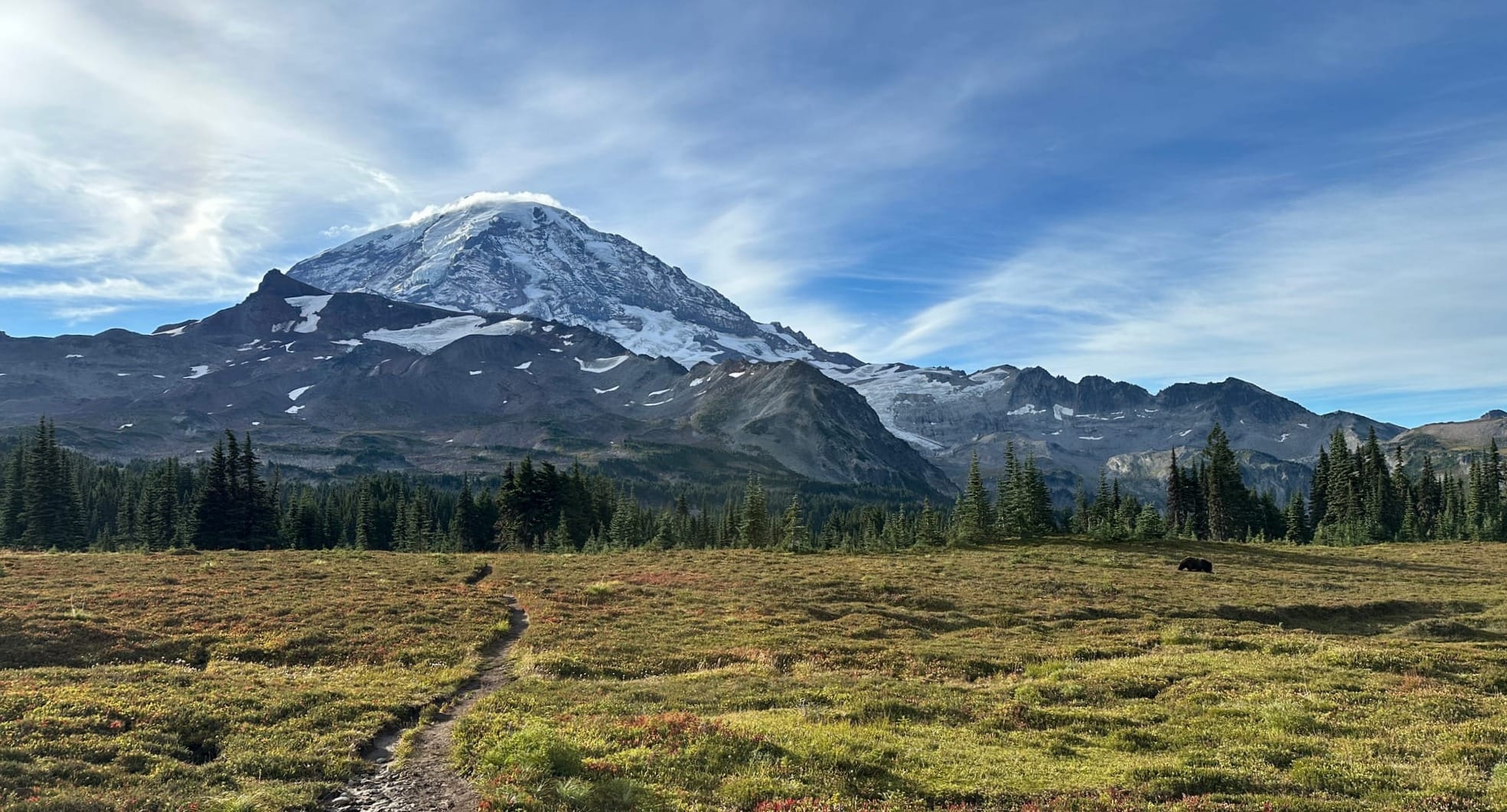
I was completely awestruck by this view, I've been around Mt. Rainier a good number of times, even on her slopes skiing the Muir Snowfield, but this one felt especially special. The early September fall had already started to deepen the colors into bronzy reds and oranges, and the marbled mix of rock and snow on the mountain was striking in the morning sun. I bounded through the meadow high on the vista until I emerged from a small batch of trees and stumbled into a black bear grazing only a dozen or so feet off the trail. Luckily he was content to eat the berries and roots in the field and seemed to pay no mind to me as I jogged on past him. Not two minutes later another bear ran out of a cluster of trees on the other side of the trail away from my "hey bear" shouts. The meadow was prolific and it set my heart leaping. I scurried up the steep climbers trail that exited the meadow for the saddle between Hessong and Pleasant eager to put some distance between myself and the bears.
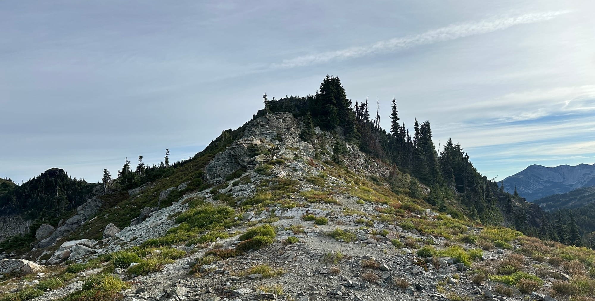
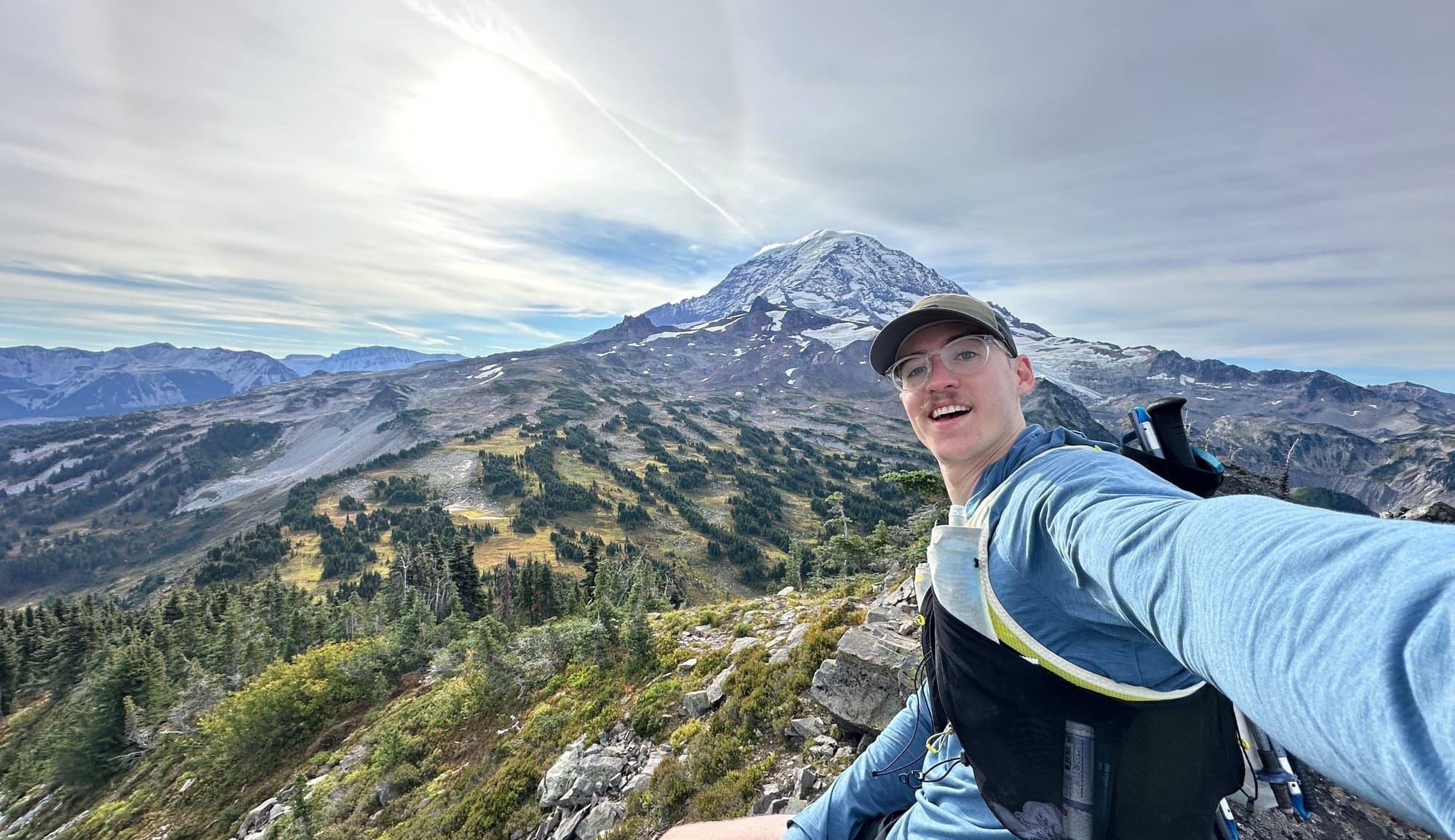
Mt. Pleasant would be rather unremarkable if it weren't for its position next to the queen of Washingtonian mountains, only achieving and optimistic 200 ft of prominence but providing one of the best places I could image to drink in the splendor of Mt. Rainier's north slopes. The wind rose as I broke over the ridge engulfing me while I took in the panorama. Once I had gotten a few pictures, I nestled into the jumbled rocks that made up the summit and dug into my snacks.
Everything up to this point had been on marked trails, even if unmaintained. I could now look over the other side of Pleasant and see Fay Peak and the Mother Mountains, connected tenuously to my position by a meandering ridgeline. I had a decision to make now, do I attempt the ridge or take the more traditional path (descending into the east gully and climbing the saddle between East Fay and the First Mother). The ridgeline was covered in small brushy trees obscuring an obvious path, but didn't have any clear drop-offs or cliffs that I felt would stop me. Without a reason not to, I went for the ridge, it was the clear aesthetic choice and it drew me in easily.
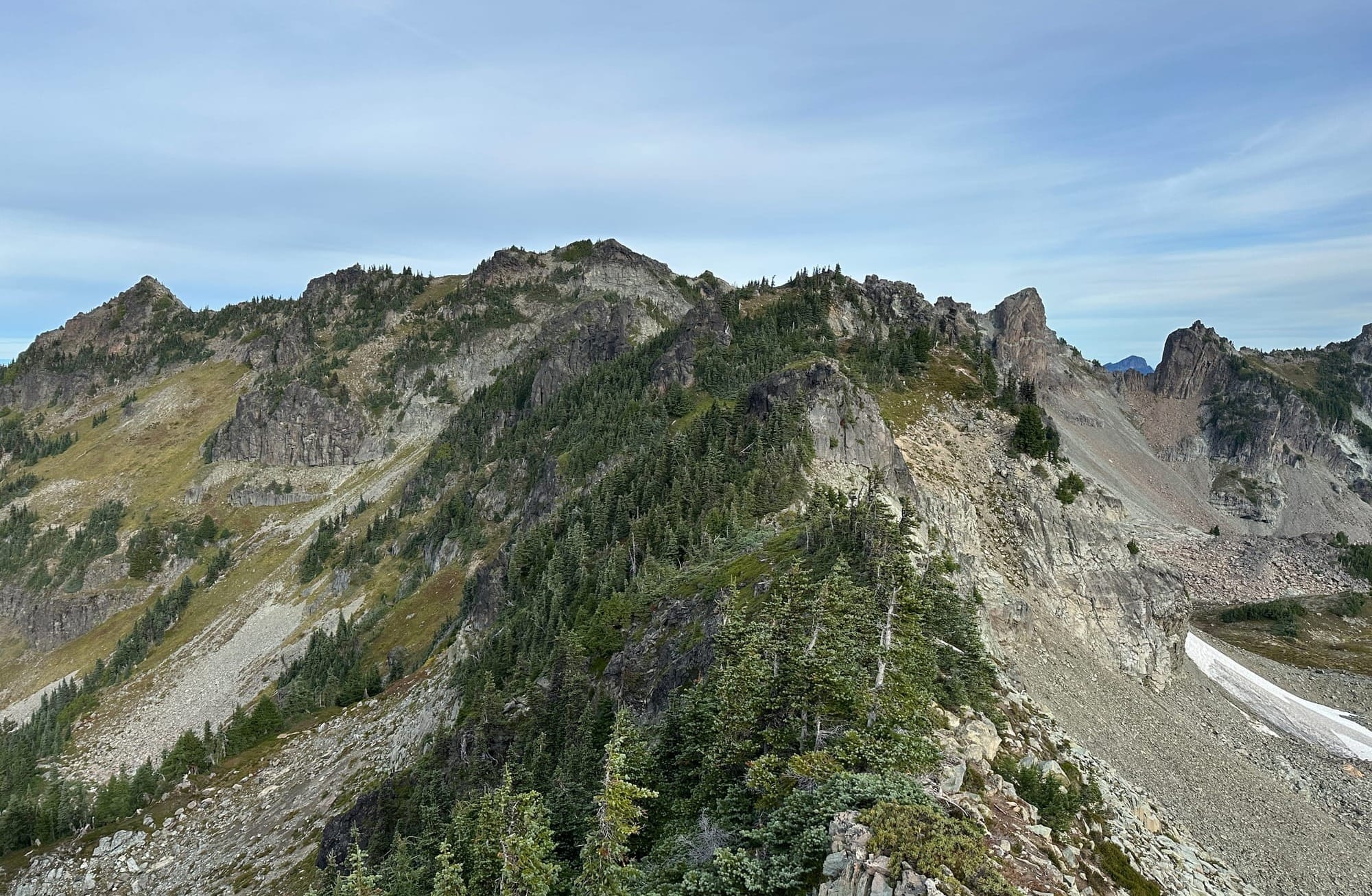
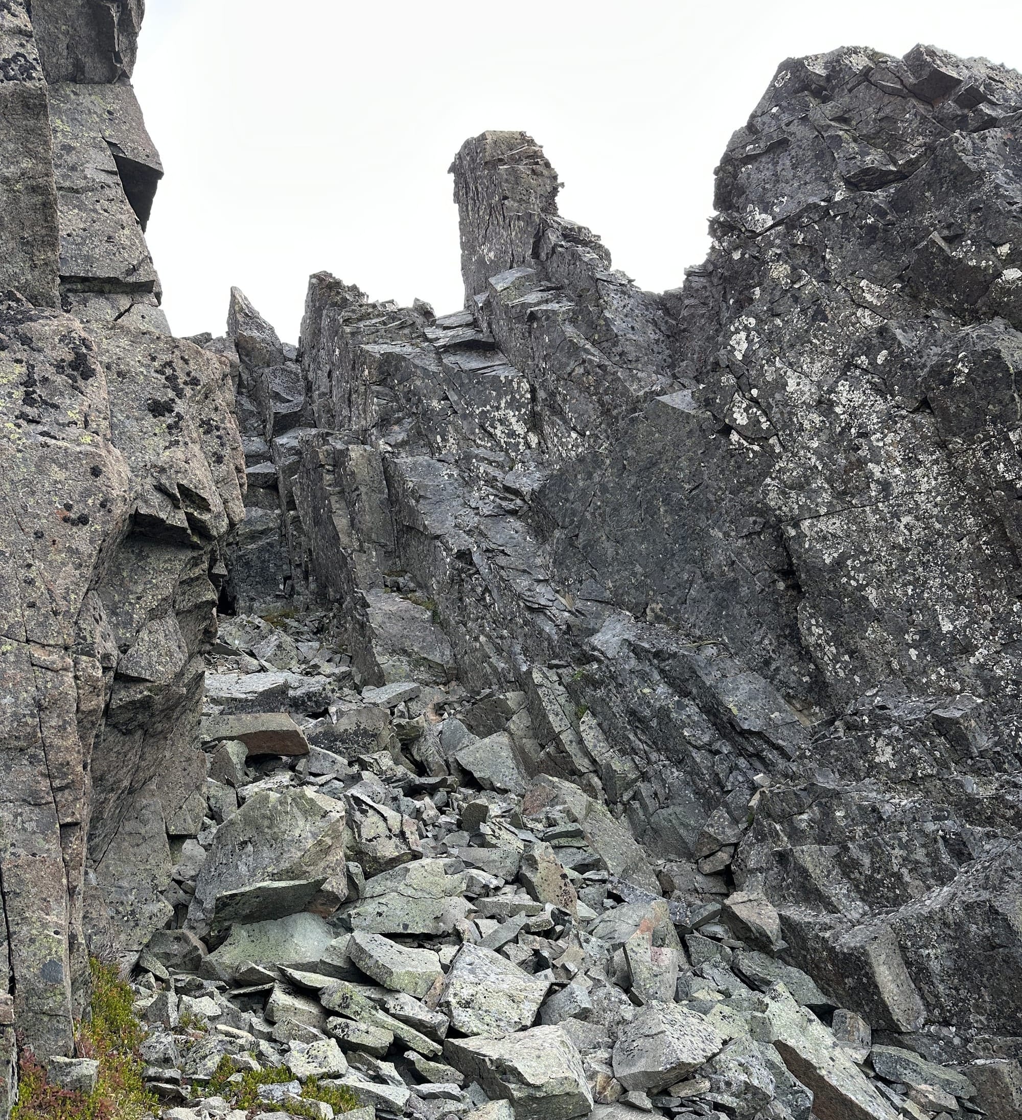
Luckily, my guess had been well-founded, traversing to the mid-point where a small tooth of rock popped out of the trees was rather easy. I kept to the east side of the ridge where there was a tenuous path above the hundred or so foot exposure to the scree slopes below. A few handfuls of brush and roots got me through without much danger. Beyond this mid-point was a notch that had been obscured from the summit of Pleasant and looked like it might pose a bit of a challenge. Past it, the ridge turned to rock for a section, mostly jumbled chockstones and piles of talus that required some careful navigation and the use of both hands. Eventually, it put me at a small ravine crossing where I had to make a couple of 4th to 5th class down-climbing moves.
After climbing out of the ravine it was only a short hop up onto East Fay, the next peak in the chain I was building. I climbed up slightly west of the true summit of East Fay and found myself having to crawl along the tops of thick pines that blocked access to the peak from this direction. After sustaining a few new cuts, I gave in and decided I was close enough to call myself there.
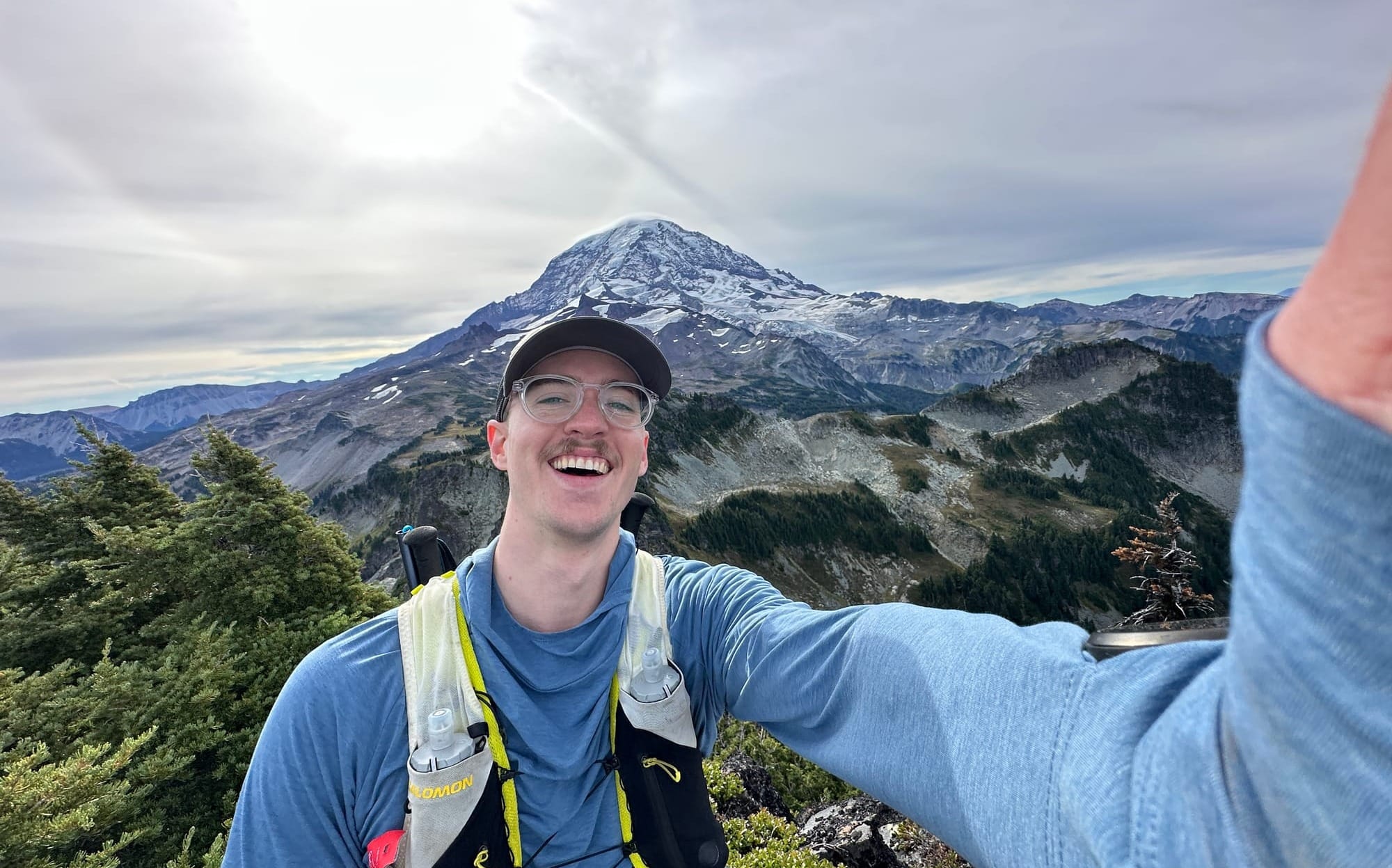
Fay Peak had been an "optional" tag on the loop since it required doubling back significantly towards East Fay before the descent towards the First Mother. But I had been making such good progress that I figured, why not, and I ran along the ridge westwards towards Fay. Unfortunately, the ridge ended suddenly and if I wanted to make it to Fay, I would have to double back (even more) and cut much lower on the south side of the ridge or scale the steep drop that loomed in front of me. Given it hadn't been in my "official" plan anyway, and not wanting to burn all the time it would have taken, I decided to continue forward towards the First Mother instead.
The descent off East Fay was more treacherous than I expected. It required contouring along the steep scree slope on the north side of the ridge until I made it to some patchy heather on the far end that rendered the hillside stable enough to descend. I was glad to have brought my hiking poles, which so far hadn't gotten much use.
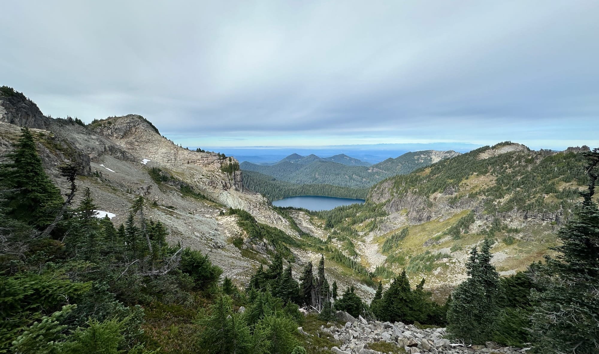
After the descent, I connected back up with a maintained trail that lead up to Knapsack Pass and towards the First Mother. My feet were ecstatic to have solid ground beneath them again, and I was able to pick up the pace tremendously after spending plenty of time cautiously placing my feet on the scree above.
While on the Fay ridgeline, I had seen a lone pair of hikers on the Knapsack Pass Trail who were also headed up the pass. The only real objective I knew about on this trail was the First Mother, I figured I might meet up with them at some point later on, but they were nowhere to be found on my ascent. Perhaps they knew something I didn't and headed over the pass into the Cataract Creek Valley. It was the only decent chance I had of seeing any other people until I made it back to the lake, and missing them was an eerie reminder of how alone I really was.
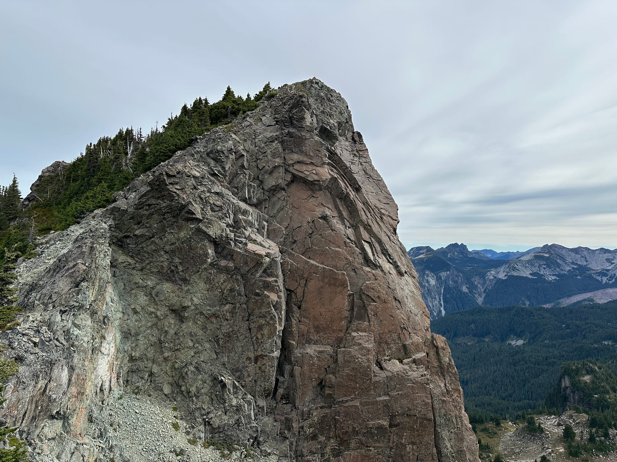
The trail steepened after I made it up to the pass and headed toward the formidable rock formation that was the First Mother. From the pass, it looked fairly unsurmountable without a heavy dose of scrambling, but there was supposedly an easy path around the west side that took you to the top without issue.
I was climbing up through a narrow meadow that opened up from the pass when I heard rustling in the trees next to me. I had seen a herd of mountain goats across the valley while on East Fay, and my mind immediately jumped to them, expecting a shaggy white friend or two to hustle past me. Instead, a bear ran directly onto the trail in front of me, stopping, and staring at me for a moment before continuing on up the trail with a steady gait.
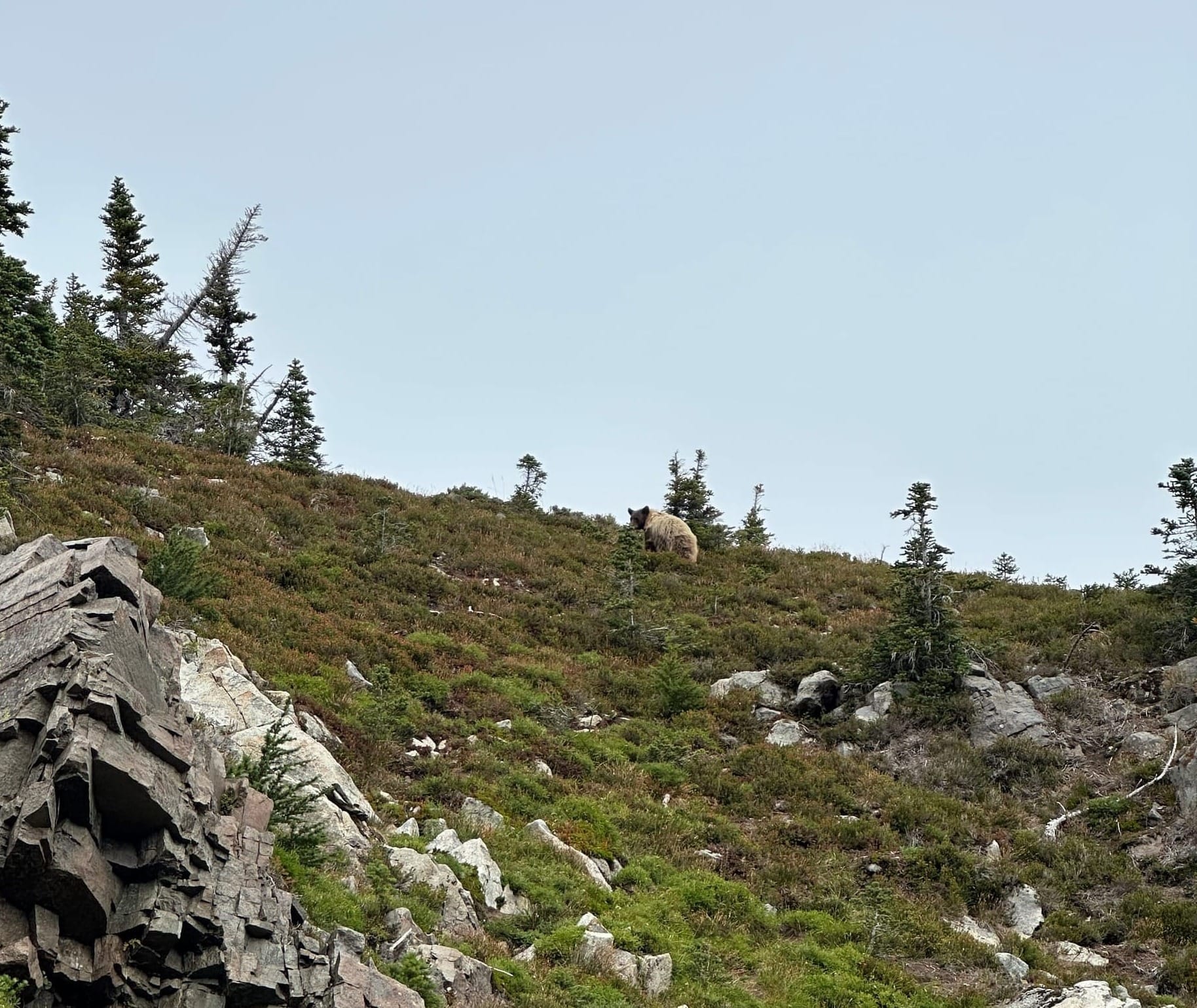
He wasn't quite the same as the others I had seen at Grant Creek, not nearly as stout, and oddly colored. A messy, light brown fur clung to him like a long-overstayed winter coat. It took a while for him to leave the trail and I was afraid this would be the end of my day. I waited 10 or 15 minutes below him, tapping my poles together and shouting, before he crested the ridge opposite the First Mother. I had no desire to follow closely behind him, so I waited a bit more to ensure he was off of my path before continuing up, much slower this time, and with a constant stream of hoots and howls pouring out of me. I wouldn't be accidentally sneaking up on him again.
I crawled up towards my objective, staying a bit off trail, opposite the direction I last saw the bear. I clambered over some rocks and through a few trees before making it onto the summit trail that took me away from the bundle of trees he disappeared into. Thankfully, he didn't appear again and I made it up onto the First Mother, which provided an incredible view of the path I had taken so far. This was the first peak that actually felt like a summit, the south side dropping precipitously off into the valley below allowing me to dangle my feet and take in the panorama.
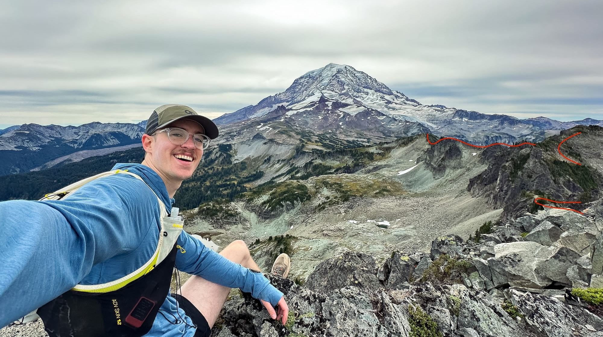
From here there was one more peak on my itinerary, Castle Peak, which involved another long off trail ridge traverse to access. Castle, in-fact, had no trails marked at all on any GPS map I could find that led to it. If I made it there I would have to bushwhack my way off and back down towards Mowich Lake. I was hopeful though, I had been making great time and it was still early in the morning. The clouds had been moving in steadily but had stayed high and brought no weather with them but cooler air.
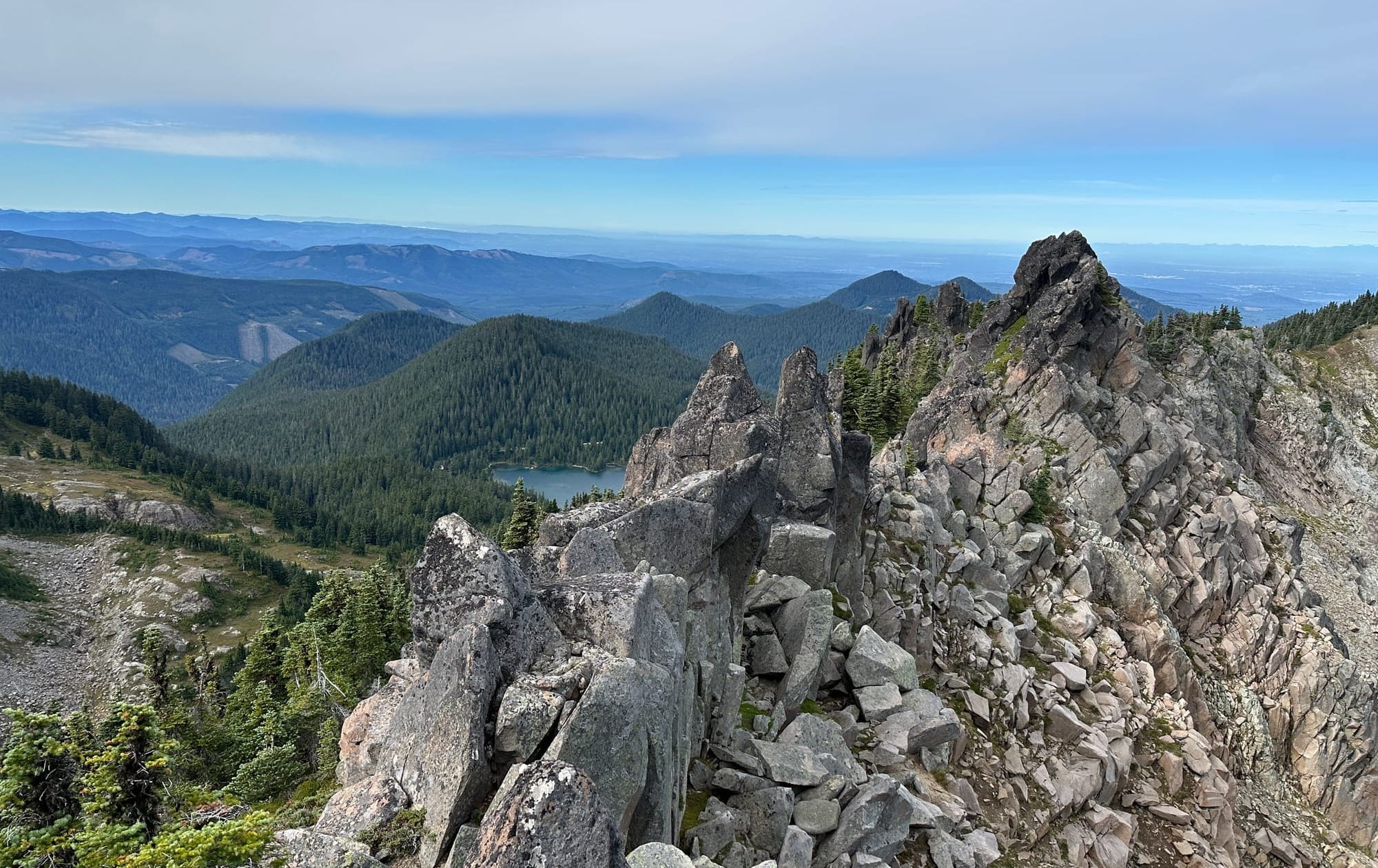
I descended the First Mother and found my way onto the ridge that would take me further towards Castle Peak. It took a bit of route finding, and I had to meander around to the northwest, through some thicker trees and loose dirt, to get below the large outcropping above the saddle. After some bushwhacking, I made it onto the ridge proper which was rocky and required some quick 3rd class moves to traverse.
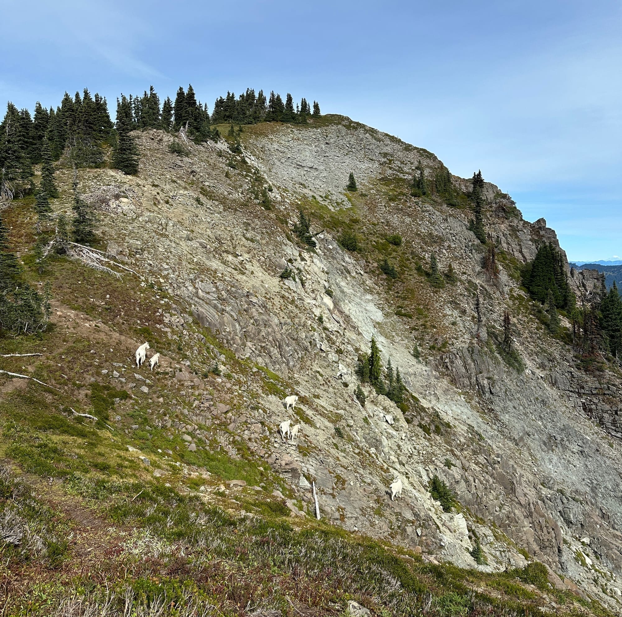
The rocky section was short lived and the ridge widened to a broad grassy knoll where a lively herd of mountain goats were grazing together. As soon as they caught sight of me, they picked up their pace moving north as if they were following the same path as I was. We ran together for a bit before they descended off of the ridge and down the steep scree into the valley below.
This was one of my favorite sections on the loop. The ground was soft, the ridge trended downhill, and either the goats or other like-minded hikers had beat a faint trail into the ridge. All of this together allowed me to run towards the rising Castle Peak at a pace I hadn't been able to manage since the start of the day. The bottom of the ridge butted up against the "south peak" of Castle which is a large rock monolith that blocks the path towards the true Castle Peak.
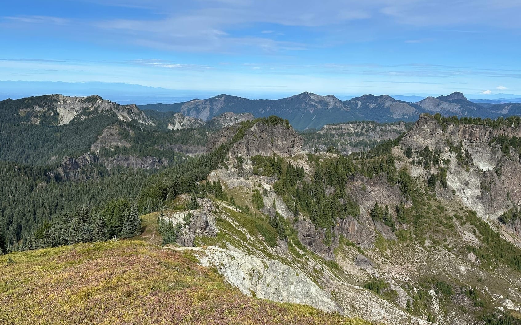
There was a thin trail that contoured beneath the South Castle rock formation which consisted of slightly loose dirt over a long sliding fall before trending upwards to the base of the rock wall staying above the steeper heather on the slope. I stayed as high as possible through here, high enough to keep my hand against the rock while I traversed.
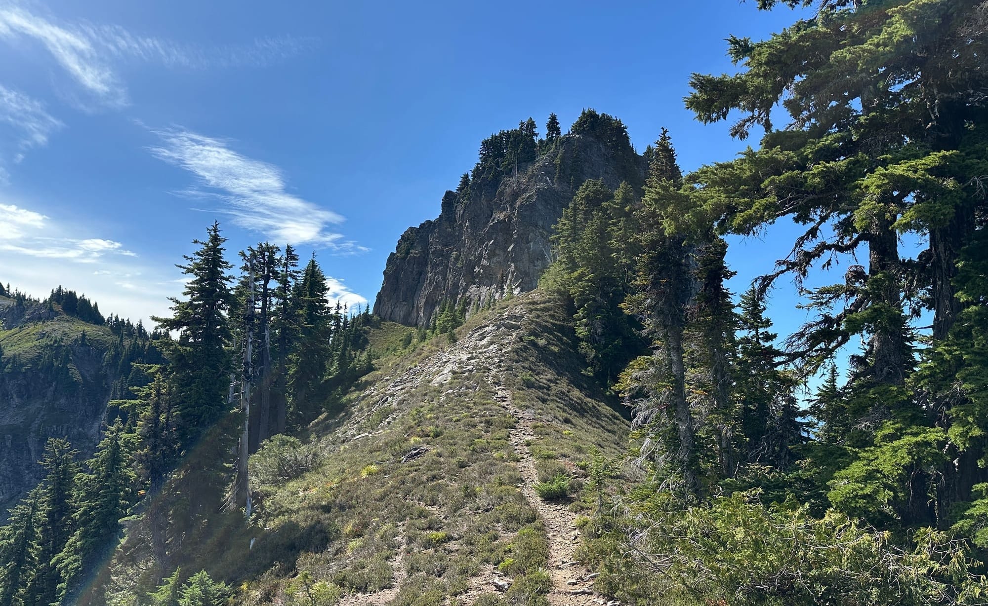
After this, it opens back up into a ridgeline for a few hundred feet before you arrive at the rock wall that forms the start of Castle Peak mesa. You can access a scree ramp on the north side of the bluff which allows you to hike all the way on top of the peak.
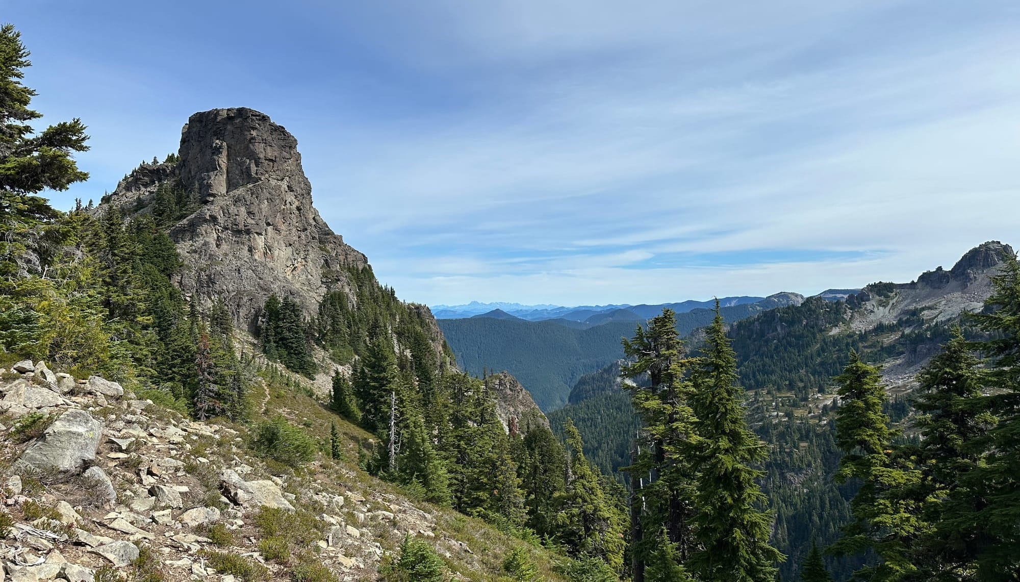
The true "peak" on Castle is at the far east end of the formation, the top of Castle is open and flat with a beautiful meadow with some low trees that allow for some fun running with views on all sides. Once you make it to the far side, the trees fall away and you can hop out onto some nearly free floating rock columns with complete panoramic views to the east.
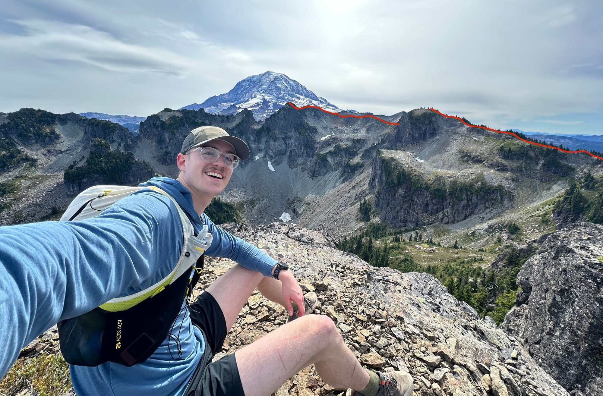
Despite the true summit being on the far end, it seemed like there was a slightly higher point on the other side, so I ran over to make sure I had tagged the "true" summit. From there you could peer over onto the ridgeline you used to access Castle from the high steep wall.
I turned back and retraced my steps, going back to the ridge before the South Castle Peak (marking the longest "out-and-back" of the day) and dropping down into the forest from the saddle notch. There wasn't any real trail here so, with the help of my poles, I made my way through low, but thick, shrubs down the slope and into the thicker forest above Mowich Lake. It wasn't long before I made it back onto the Wonderland Trail and got to run again, trending down toward and then around the lake, back to my starting point. By this point, the sun had returned to the sky and I was sweating as I ran past all the families and hiking groups who had made it out later in the morning to tag Tolmie or Ipsut Pass. I couldn't wait to dunk my head in the sure-to-be ice cold water of the lake.
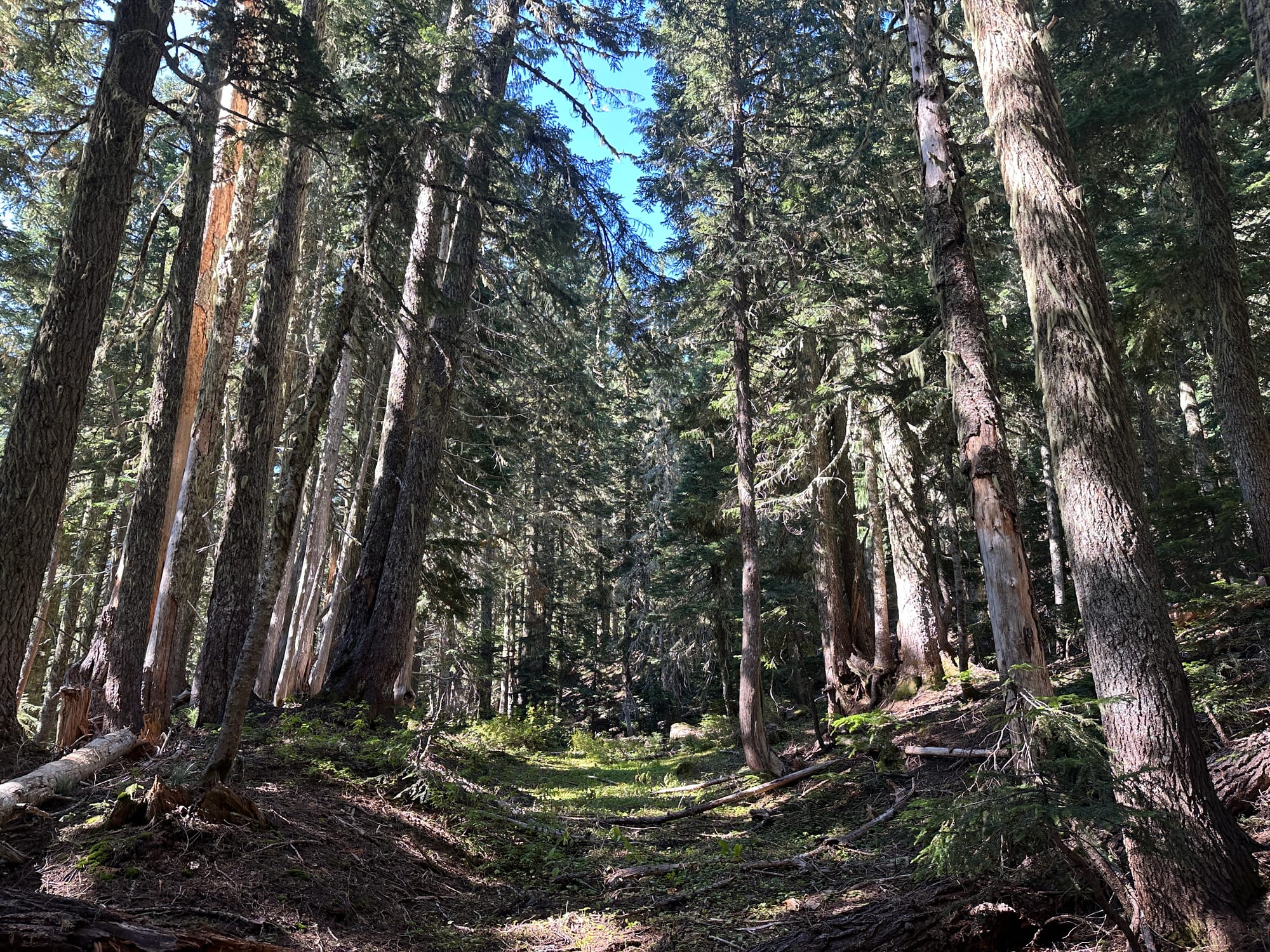
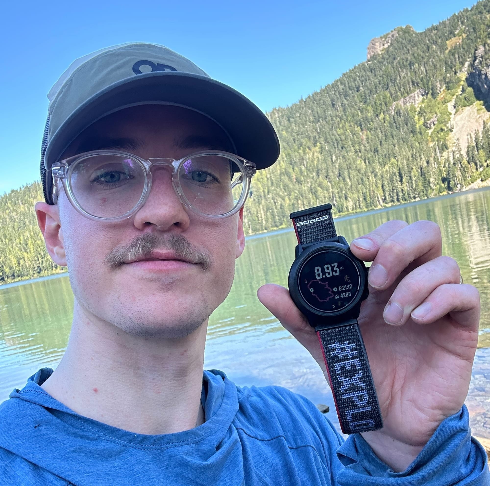
Round-trip it was 8.93 miles and 4268 ft of ascent (and a mirroring amount of descent) and a ton of fun! It was fairly approachable as a run/scramble and ridgeline ascent. Only mild route finding required, and entirely at a small scale as the objectives are almost always visible. A decent amount of exposure but over easy terrain, with only a few spots of difficulty where you have to actually climb.
I think tackling this in the direction I went (counter-clockwise) is the best way to do this particular loop. Dealing with the ascent towards Castle would have been rough without any trail, and the ascent towards Pleasant was rather enjoyable. There are a couple of great additions you could add if you wanted to extend this loop, including hitting Fay Peak or Hessong rock, which are both easily accessible. You could even make it more of a climbing mission by adding in Mist Mountain east of the First Mother or the South Castle Peak (or the rest of the mother mountains in the range!)
The loop took me 5 hours and 41 minutes and could definitely be improved upon with better route finding (or the knowledge outlined here). Let me know if you have done this route before or take it on in the future, would love to learn about additions and improvements to the loop.
Here are some other resources including the GPX track and and other reports:

Thanks to Madeline (my wonderful wife) for editing and making sure I don't sound like an absolute baboon ❤️
